| Home | > | List of families | > | Scrophulariaceae | > | Aptosimum | > | decumbens | > | Record no. 24606 |
Details of record no: 24606
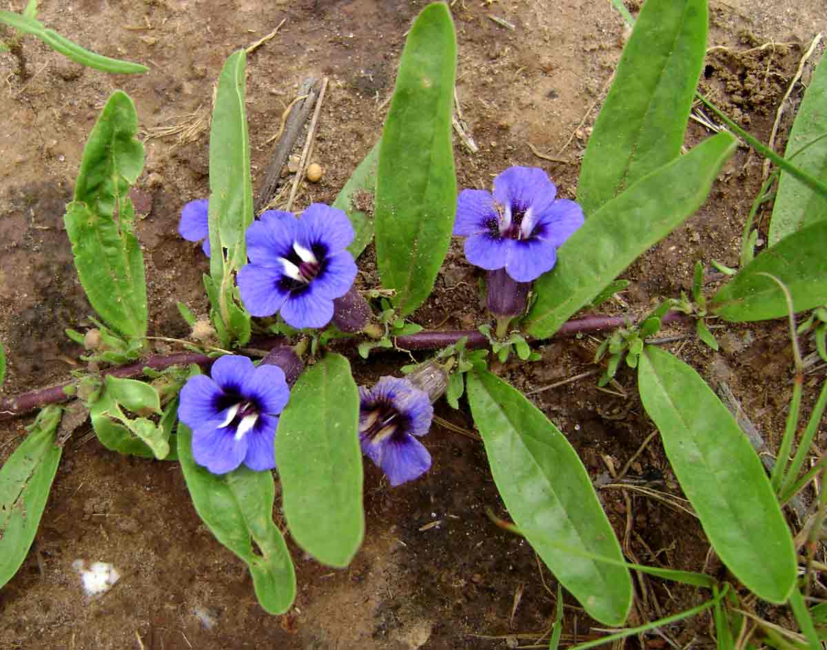
Aptosimum decumbens
Three blocks of information are displayed on this page, namely: (a) details of the record; (b) the record point plotted using Google Maps and (c) any images attached to the record. Please scroll down to see the various items.
Record details:
| Date: | 02 Feb 2008 |
| Recorder(s): | H Pickering |
| Collector(s): | |
| Determiner(s): | |
| Confirmer(s): | |
| Herbarium: | |
| Habitat: | Kalahari sands, open savannah |
| Location: | Farmland just below the Makuni ridge about 7km east of the road between Livingstone and the Falls, turn off about 300m south of the Maramba river |
| Location code(s): | 120 |
| Outing code: | |
| Planted code: | Not planted |
| Country: | Zambia |
| Quarter Degree Square: | 1725D4 |
| Grid reference: | LL828223 |
| FZ Divisions (Flora Zambesiaca): | S |
| Current administrative provinces: | S |
| Altitude (metres): | 920 |
| Notes: | |
| Latitude, Longitude: | |
| Location Accuracy Code: | 0 |
Map of species record
Images:
Image: 1

| Species id: | 150920 |
| Image id: | 1 |
| Image number: | 5837 |
| Photographer: | H Pickering | Picture label |
| Code 1 if image of a herbarium specimen: | 0 |
| Herbarium in which image taken: | |
| Code 1 if image not to be displayed: | 0 |
| Image notes: | |
| Home | > | List of families | > | Scrophulariaceae | > | Aptosimum | > | decumbens | > | Record no. 24606 |